Nationwide 3D Laser Scanning Services For Commercial Developers
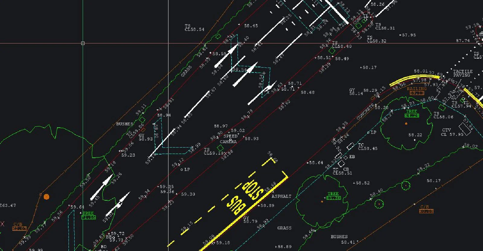
Nationwide 3D Laser Scanning Services For Commercial DevelopersWe specialise in 3D laser scanning which is high-definition surveying; a method of collecting high-density spatial data sets in a fraction of the time taken by traditional systems. The scanner emits a laser horizontally and vertically, rotating through 360?. The reflections are detected; as many as 100,000 are possible per second due to internal mirrors and rotation, so this surveying technique is capable of unparalleled precision and detail. As well as collecting the standard data usually targeted during a survey, the intensity of the reflected light and the distance of the objects are evident in the point cloud data set.
Our highly skilled surveyors use the millions of surveyed points to produce 2D drawings, 3D models or simple jpeg images as requested by the client. A laser scanning survey can be viewed as a fly-through of a 3D CAD model, viewed panoramically from different perspectives, with zooming for detail and overlaying of photography to give you a very real and usable visualisation of your project.
Visit the SJ Geomatics Ltd website for more information on Nationwide 3D Laser Scanning Services For Commercial Developers
ENQUIRY FORM